 As I said yesterday, we decided to leave Tucson and Gilbert Ray campground a day early, and break our trip to Guadalupe Mountain NP into two days. We realized that if we drove to Las Cruces, NM, we would have enough time to take a side trip to White Sands National Monument. We arrived at Las Cruces about 2 pm and after dropping the trailer at an RV park, we headed to White Sands NM. It was about an hour drive, and well worth the trip.
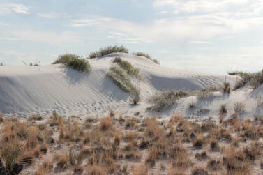
White Sands National Monument is a very large area of sand dunes, many miles in length in the middle of the desert. The sand is gypsum that comes from mineral deposits at a lake which is broken by weathering into sand, and blown into dunes. It is quite remarkable to see this area of white sand dunes in the middle of the desert. We drove up the road they plowed through the sand, about 8 miles north from the visitor center. The dunes are quite extensive and quite interesting to see. In these photos, the sand looks rather gray. I think my camera's white balance needs adjusting for scenes like this.
0 Comments
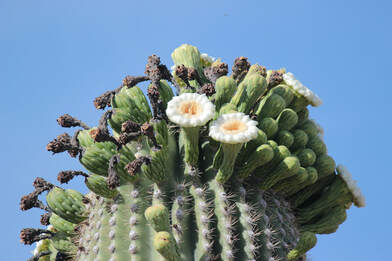 When we got up in the morning, the Saguaro cactuses had opened their blooms. This photo is of the very top of the very tall cactus. The blooms seem to be out only for a short while, probably because of the heat.
We went to the Arizona-Sonora Desert Museum which is just a few miles from our campground, Gilbert Ray. This was an excellent experience. The Museum is mostly outdoors, which is why we went first thing. The forecast was for 100 degrees, and it was already hot at 9 am. 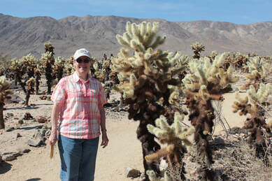 We left TwentyNine Palms and drove through Joshua Tree NP to the south entrance. It is a real contrast to see the high desert where the joshua trees grow and go down to the low(er) desert where different plants grow. The Cholla Cactus Garden was worth a stop. The Ocotillo bushes were not in bloom as they were the last time we were here.
Then it was off to Tucson and Saguaro National Park. We mostly drove along Interstate 10 for the rest of the day, and reached Saguaro NP just after 5 pm. Of course, the visitor center closes at 5 PM, but there was a volunteer who took a few minutes to provide us with an orientation to the park. Then we drove to Gilbert Ray Campground in the Tucson Mountain County Park. What a great campground! We were in the midst of saguaro and other cactus and it hardly seemed like we were in a developed campground.  We started the day by going to Split Rock and taking the 2 mile loop there. We were told that there were still wildflowers there, and the report was right. Although they were not stunning, there was a lot of variety and flowers all along the trail.
We went out to Keys View for a great look toward Coachella Valley and beyond. If the smog were less, you can see to Mexico, but there was enough haze to limit visibility. Still a great view. We then went to Quail Springs for lunch. It is a very nice picnic area next to a large rock that some were using for rock climbing. It didn't look as challenging as some, but it would be great for beginners. 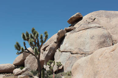 We were last in Joshua Tree NP in 2010, and strangely, it looks about the same now as it did then. That's a good thing. On the first day, we stopped at the Visitor Center and learned that there was a ranger-led hike at Skull Rock starting in 15 minutes. We decided to go there as we really have learned a lot from these ranger-led hikes. We made it as she was beginning her comments. The hike was great and we learned about the geology of Joshua Tree NP including that the rock formations so favored by climbers and walkers are made of granite that has begun to decompose - into sand. The granite and other rock formations are what is left after the weathering and erosion of the rocks. In other words, the piles of rocks didn't rise up, but rather, the rest of the terrain was eroded away leaving the piles of rocks that were tougher than the other terrain. It is very strange to see a pile of rocks several tens or hundreds of feet tall and realize that they weren't piled up but that the rest of the terrain eroded away.
|
2016 SouthwestRetirement is great. We bought a travel trailer and are exploring National Parks. (Actually, we bought one and sold it and bought a second one better suited to us. It happens...) And I have time to do some woodworking projects and things around the house. And now I have gotten interested in ham radio so there goes any free time. ArchivesCategories |
 RSS Feed
Copyright © 2023 by Dornbush Web Design